Friday, August 12, 2011

Burgess Falls State Park

Burgess Falls State Park located near Sparta TN has a 1.5 mile round trip river loop trail which takes you past 4 waterfalls.  The most popular of these waterfalls is the 130 foot Burgess Falls.  It is well worth the trip if you are in the area!


Rock Island State Park

Rock Island State Park in Rock Island, TN. has 2 nice waterfalls that can be seen with very little walking.  Great Falls can be viewed from the parking area next to the cotton mill building on Great Falls Road.  The 80 foot Twin Falls can be viewed from the parking area at the end of a gravel road.  The park has previously hosted the U.S. Freestyle Kayak Team Trials, so you may get to see a few kayaks taking on the currents.  The park also has several trails which I have not hiked.


Benton Falls FS Trail 131

My Rating: Easy

Features: 65 foot waterfall

Getting There: From Cleveland take 65 east 16 miles to the Ocoee Ranger Station.  At the ranger station turn left onto forest service road 77 for 7 miles.  Turn right into the Chilhowee Recreation Area.

Description: From the Chilhowee Recreation Area take trail 131 for 1.5 miles slightly downhill to the base of the falls.  The trail is well maintained and blazed in blue.  Handrails and steps lead down to the base of the falls.


Thursday, October 22, 2009

Scenic Spur FS Trail 78

Scenic Spur FS Trail 78


My Rating: Easy to moderate

Length: 1.7 miles

Features: Rock cliffs, waterfall, creek.

Getting there: From Cleveland take 65 east 17 miles. Turn left on the road to the Ocoee work center. Trail head is 0.1 mile on left.

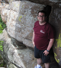
Description: The trail is well marked and maintained. There are several other trails connecting to Scenic Spur trail but signs keep you on the right track, just follow the "to waterfall" sign. There is a little climb at the start of the trail but it only last abou 0.1-0.2 miles. From there the trail is easy until you reach miles 0.9 and 1.3. At these two points you will have to cross the creek. It is a ver shallow creek but it could be deep if there was alot of rain in the area. Starting at about mile 0.5 the trail follows the crrek and follows it the rest of the way to the end. The trail ends at a nice little waterfall with alot of cool cliffs and small caves.
 

Tuesday, October 13, 2009

Falls Branch FS Trail 87

My Rating: Easy to Moderate


Length: 1.3 miles


Features: Great 55 foot waterfall


Getting There: From Cleveland take 65 East 8 miles. Turn on 411 and follow it 20 miles and turn onto 310/39 for 14.5 miles. At Tellico take 165 for 23 miles. If you reach the North Carilina border you have went 2 miles too far. The trailhead is on the right hand side of the road at what appears to be another overlook.


Description: When you first get on the trail make sure you take the trail to the left. The trail to the right is Jeffery Hell trail. The trail is not well blazed but the path is pretty easy to follow. The trail is easy with a few small inclines and decents until about 1.1 miles in. There it takes a tougher decent which can be slippery when wet. At about mile 1.2 you will come to the creek and can see the falls on your right. The trail continues after crossing the creek and leads all the way up to the waterfall. THIS WATERFALL IS WELL WORTH THE TRIP! You will not be sorry that you hiked this one!


Thursday, October 8, 2009

Lowry Falls Trail 168

Lowry Falls Trail 168

My rating: Easy to moderate


Length: 0.3 miles


Features: Several small waterfalls


Getting there: Latitude: 35.2231291 Longitude: -84.536042

From Cleveland take US 64 East 8.0 miles. Turn right onto US 411 North for 11.8 miles. Turn right at TN 30 East for 2.2 miles. Park at Taylor's Island parking on left side of road. Walk along side of TN 30 East for 0.15 miles. Sign for trail is on right hand side of road.


Description: Lorwry Falls Trail is an easy to moderate trail which features several small waterfalls and some nice rock and cliff formations. The trail is well maintained and marked. Most of the trail is even but there are a few small inclines which could be considered as moderate although they are pretty easy even for a beginner hiker like myself. About 0.25 miles into the trail there is rock bluff that runs beside the trail. Walk under the bluff to reach the best waterfall along the trail.